Google Maps Gets Deeper Into Las Vegas With 360-Degree Views
Skift Take
For tourists researching whether a destination is worth a visit or not, it’s no longer enough to rely on TripAdvisor reviews or word of mouth to convince them: They want to get an inside look at a destination before making any decisions to see if the wow factor is there.
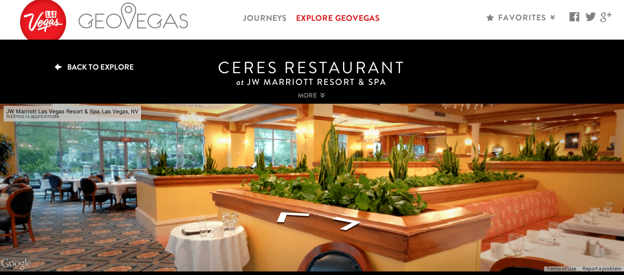
Google recognizes this need and launched Google Maps Business View in 2012 to help destinations give potential visitors 360-degree virtual tours of multiple businesses and attractions in a destination. Google Maps Business View imagery is collected by a Google photographer with a tripod and a fisheye lens.
Then the series of high-resolution panoramic photos collected on-site are stitched together to create a 360-degree interactive experience, using a Google moderation tool. The final product is owned by the business owner, and Google says a typical project costs only a few hundred dollars for businesses.
“People like to see images, and it’s a really powerful way for travel destinations to showcase themselves in an easy and accessible way,” said Soufi Esmaeilzadeh, the product manager for Google Maps Business View. "This is how this product is different than Google Maps or Google Earth, you get to go inside a business and get an in-depth look at the property."
Google provides a list of local photographers contracted for these projects, but business owners seek them out. The amount of times photographers come to a property and what they photograph is at the owner’s discretion.
Both interior and exterior photos are usually taken, and photographers are available to return to businesses to take updated photos when needed. Globally, Google has a few thousand photographers for these projects.
Anyone can access Business View on desktop, mobile, and tablet. The “See Inside” marker on search, maps, and Google+ takes people into the 360-degree experience.
The product is available in 30 countries, and since launching more than 250,000 businesses have used the service and now virtual tours. Most of the businesses and destinations using it are located in North America or Europe, with some tours now in Asia such as Indonesia or Japan.
Esmaeilzadeh said two noteworthy examples so far are projects for Andorra and Las Vegas. Andorra’s project helped multiply visits to the country by 50 times, and the GeoVegas project has seen half a million page-views since launching in June with about two dozen businesses and attractions in the city.
The number of GeoVegas page-views mirror those of the main Las Vegas tourism site for the same period, as the two sites are separate entities. The city also found people spend an average of five minutes on the GeoVegas site.
“Google has the largest scale for what we were looking for,” said Chris Evans, a spokesperson for Las Vegas tourism. “GeoVegas really helps people learn more about today’s Vegas, in addition to reaching arm-chair travelers.”
He feels Google is on the “cutting edge” of virtual tours and that these will eventually be standard for all destinations.
“GeoVegas can also be a sneak-peek into a part of a property that a traveler never knew existed,” he said. “It helps clear-up outdated opinions about Vegas.”
Las Vegas ran a YouTube masthead campaign from June to August for the project, another benefit of working with Google for its ownership of the video-sharing platform.
“When you Google a Las Vegas business part of the project, their Google Maps Business View tour now shows up as well,” he said.
The overall project took about a year to complete, and the five photographers hired spent an average of one to five days at each property, and then a few months for editing.